


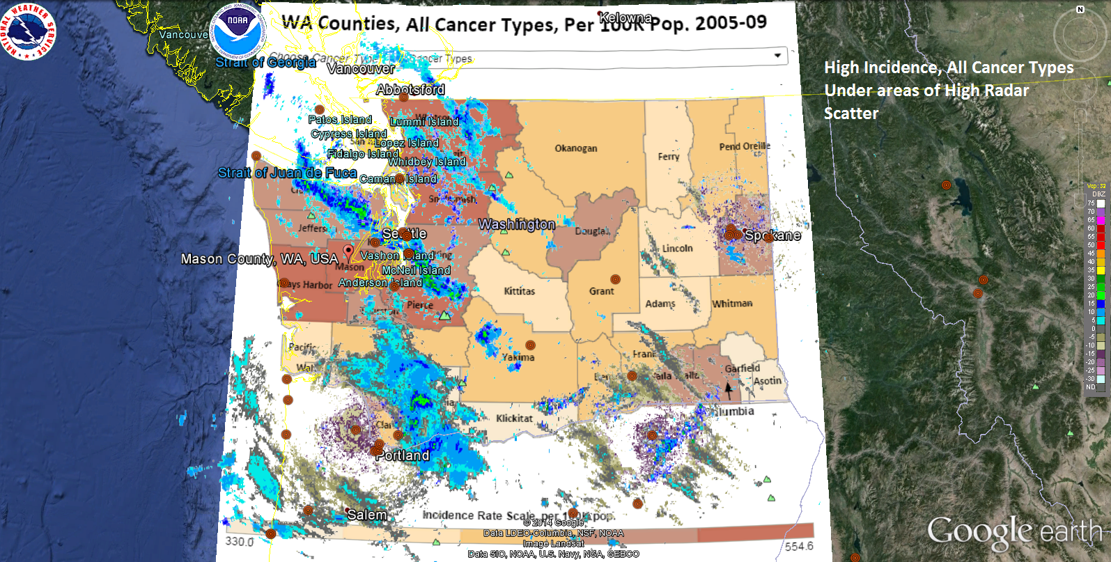
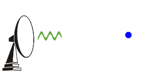
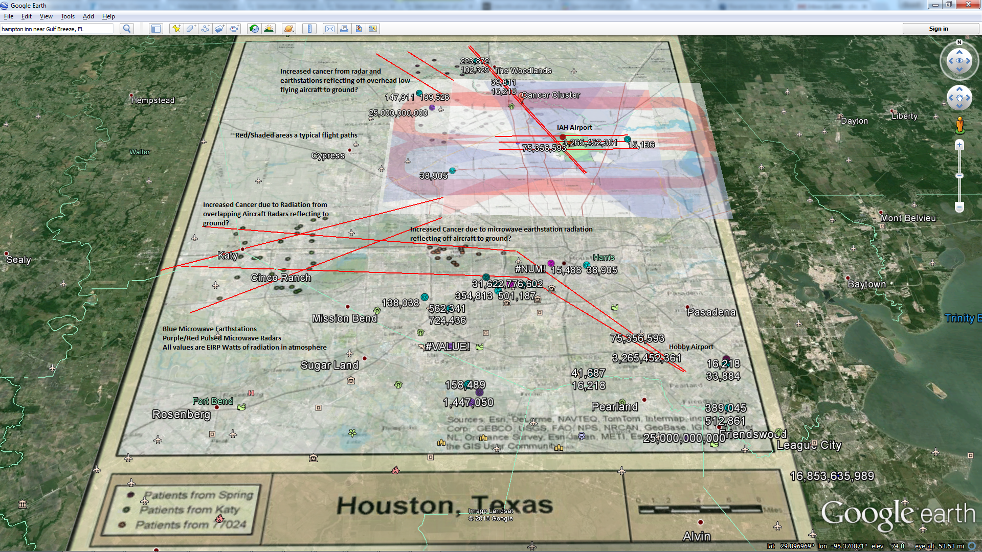
The Microwave Radiation Scatter you see on the map (that is radiation refracting off clouds, NOT CLOUDS) correlates highly with the areas of high melanoma in Vermont. The government appears to be MICROWAVING YOU. They are doing this because they don’t know the difference between power and energy. They are damaging your RNA and DNA with each pulse of those radars.


“The world is dangerous not because of those who do harm, but because of those who look at it without doing anything. Nothing that I can do will change the structure of the universe. But maybe by raising my voice I can help the greatest of all causes … goodwill among men and peace on earth.” —
Albert Einstein
Thanks Al, we need that right about now…

Counties with higher autism incidence correlate well with areas of higher precipitation and radar stations
http://archpedi.jamanetwork.com/article.aspx?articleid=380363
Autism Prevalence and Precipitation Rates in California, Oregon, and Washington Counties
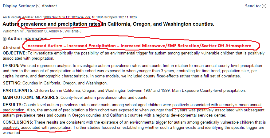

Seattle area gets lots of precipitation/cloud cover year round. They also have lots of radars/EMF sources that create chronic reflection. 2.7-3.0 GHz reflection area matches well with high autism rate area.


Pretty Good Correlation Between Increased Melanoma Rates and Pulsed Microwave Radar Tower Locations in Virginia

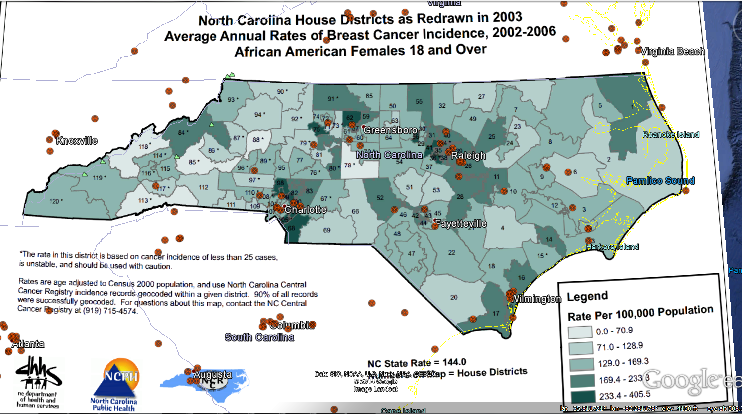
Reasonably Good Correlation Between Increased Melanoma Rates and Pulsed Microwave Radar Tower Locations in North Carolina
You can download my radar database here
“According to the Centers for Disease Control and Prevention (CDC), the highest rates of melanoma are in some of the cloudiest states, like Washington, Oregon, and Vermont. Rates are per 100,000 residents, and it should be noted that data is not available for Arkansas or Minnesota.”
May be because they have more reflected/refracted/scattered microwave radiation in all of the cloudy areas!


Good Visual Correlation between Pulsed Microwave Radar Locations and Higher Incidence of Breast Cancer in NC
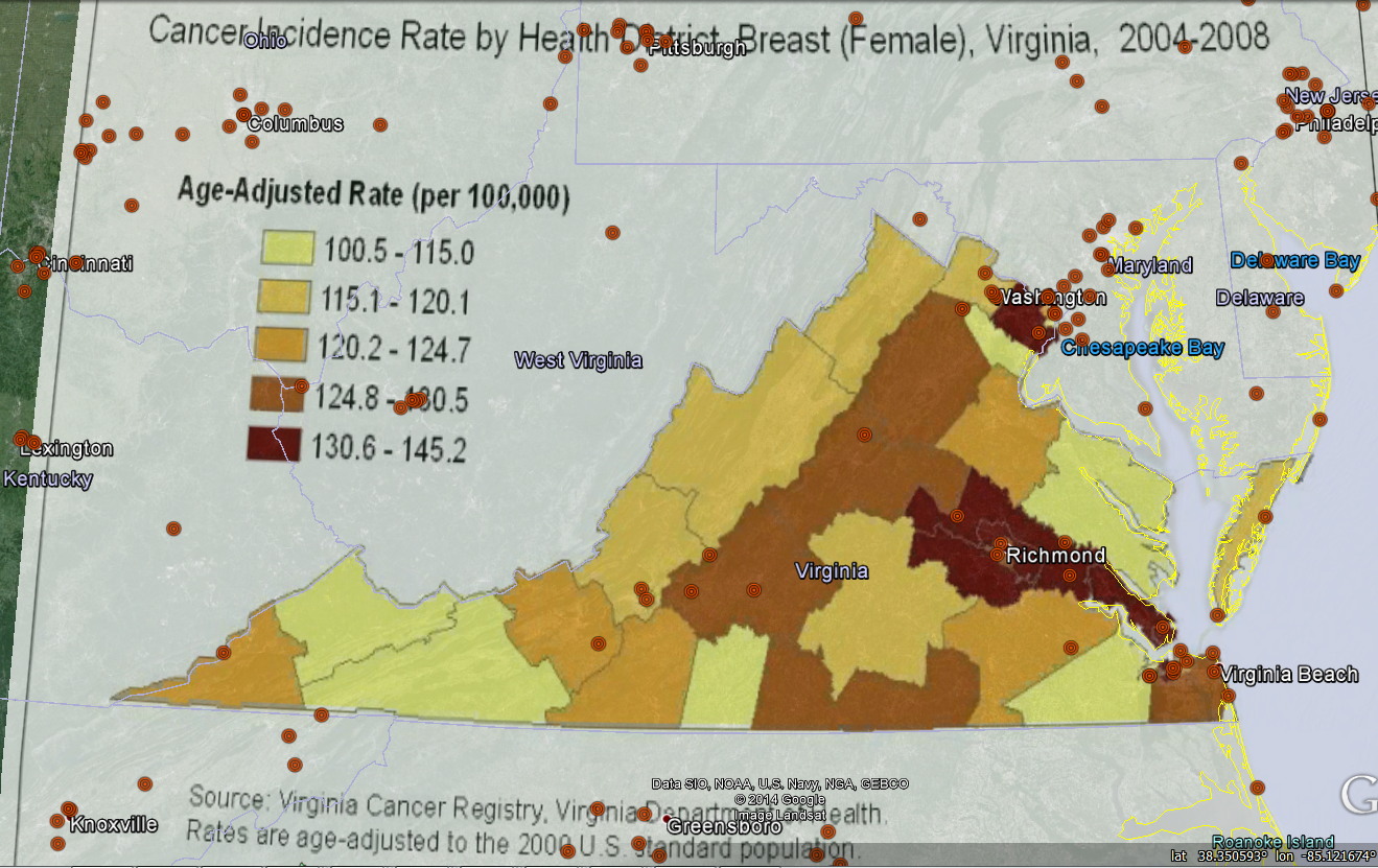
Good Visual Correlation between Pulsed Microwave Radar Locations and Higher Incidence of Breast Cancer in VA

Melatonin Crop Circle I made in My Spare Time in The Dark with My Michio Kaku Crop Circle Extension Microwave Wand. Click Here for More Info
I realize the title of this post might get me slapped, but I am only trying to help…


