
Up $h!t’s Creek?
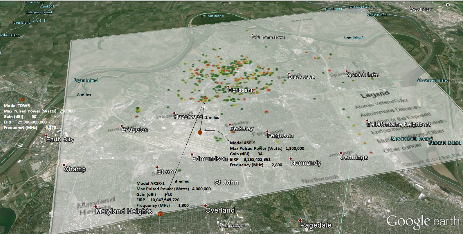
Large autoimmune, MS and cancer cluster near 1,300,000 watt pulsed ASR-9 Airport Radar installed in 1990
An informal survey of 3,300 current and former residents of north St. Louis County shows that more than one-third have developed cancers, a rate the residents blame on radioactive contamination of Coldwater Creek, which runs from St. Ann to the Missouri River.
The findings contradict a state health department report, but a group of women who grew up in North County say they’ll keep pushing for a more thorough investigation.
Cancer is second to heart disease in leading causes of death. One in two men and one in three women will develop cancer at some point in their lives. But the Coldwater Creek group says it’s the rarity of their illnesses, and the young ages at which they strike, which have them questioning the creek. Its water flooded their basements and lured them to play on its banks as children.
“We understand that disease happens, and it’s not always radiation,” said Kim Visintine, a native of Florissant and co-leader of the survey. “We’re talking about extremely high rates and rare episodes.”
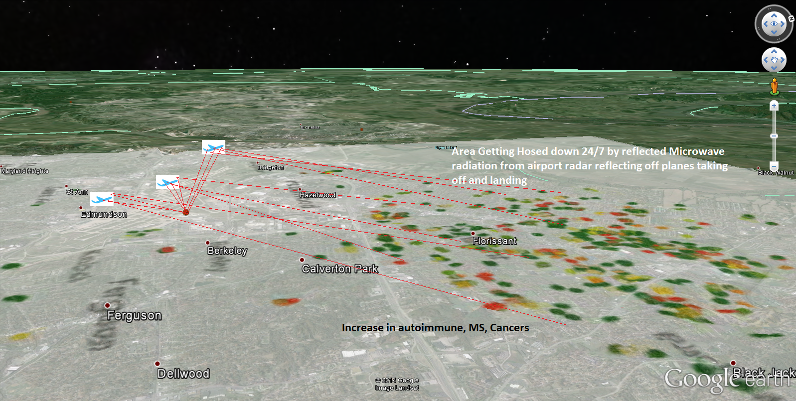
Max Pulsed Power Density @ 2 miles from radar = 25.4 watts/sq. meter. That is doing the damage. Since the radar is close to the runway I think the radiation is bouncing off the airplanes and back to the surroundings 24/7
UNITED STATES of America, Plaintiff, v. CITY OF BERKELEY, Defendant.
United States District Court, E.D. Missouri. May 3, 1990.
“Berkeley asserts that the site chosen for the ASR-9 project is unacceptable because of its proximity to Berkeley High School and to the proposed site of a recreational complex. Berkeley also contends that the Government has failed to consider the impact that the chosen site will have on economic development in the City.”
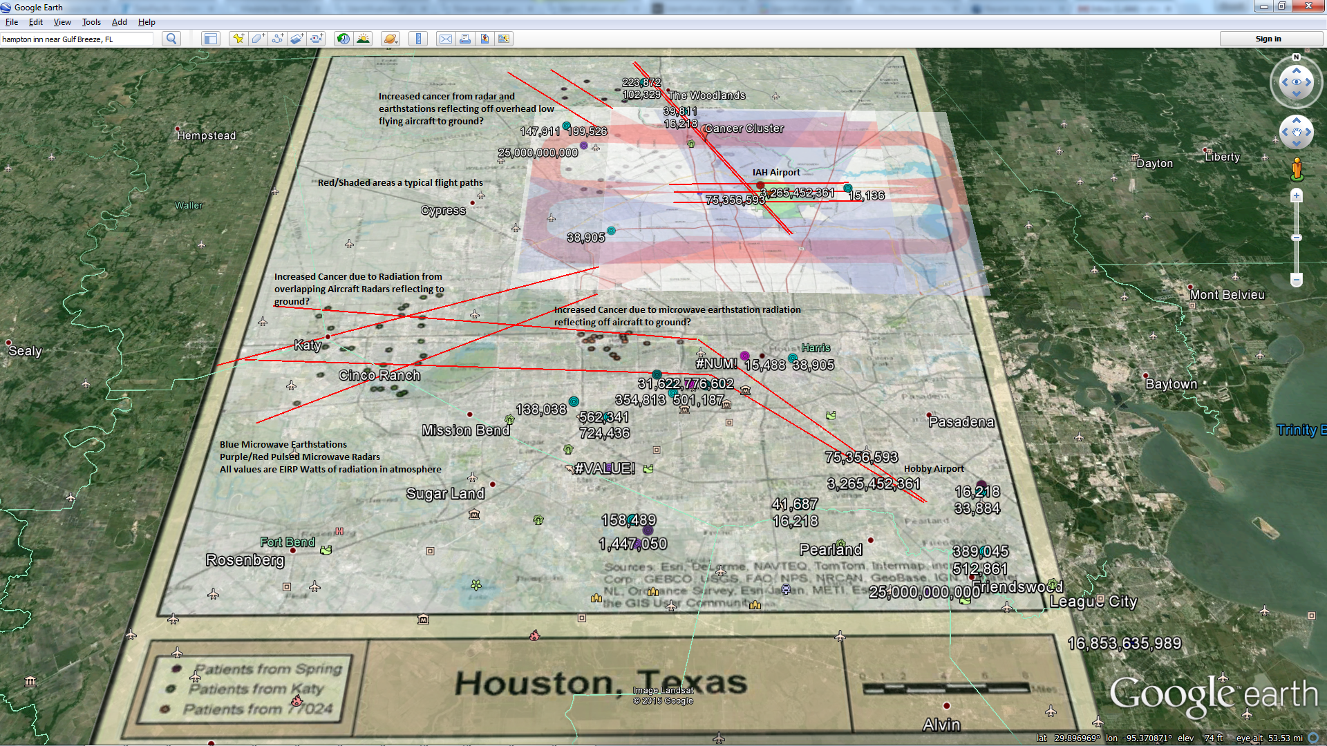
“The Government, acting through the FAA and the Department of Transportation, conducted two environmental assessments of the project. Each of these assessments resulted in the issuance of a Finding of No Significant Impact (FONSI). See FONSI of 5/9/89 & FONSI of 3/16/90, Govt. Exh. 5. As a result of these assessments,[735 F.Supp. 939] the FAA concluded that the ASR-9 project would have a minimal to non-existent economic impact on the City of Berkeley. See FONSI of 5/9/89 at p. 2 & FONSI of 3/16/90 at p. 1. The FAA also considered the possibility of exposure to radiofrequency (RF) radiation from the ASR-9 transmitter and concluded that “[t]he only areas in the vicinity of the proposed ASR-9 that would be adversely affected by RF radiation are those within 280 feet of the antenna and in front of, or directly above, the main beam.” FONSI of 3/16/90 at p. 4. The main beam is emitted from the center of the antenna at a height of 65 feet and at an angle above the horizon of 2½ degrees. Id. Thus, the main beam is located approximately 70-73 feet above ground level.” What if the beam reflects back off an airplane? What if there are two other High Power, overlapping radars nearby? Where is the study backing up the 280′ safe distance? Or was that some dweeb with a calculator making assumptions and confusing power and energy?


