

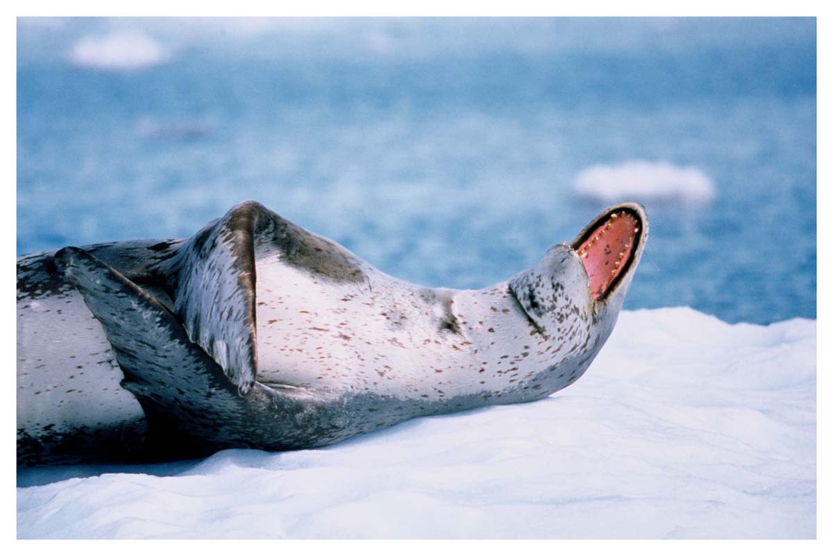
Now that I’ve solved string theory, dark matter, dark energy, as well as the cause of the increase in Autism and some cancers and our dead coastlines and coral reefs, I thought I would look for Bigfoot. I’ll be on vacation in the mountains for the next few days. It’s all yours.
Here is a song to remember me by

Get out your tin foil hats!
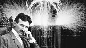
Electrical Engineers and Physicists are Stupid Funny!

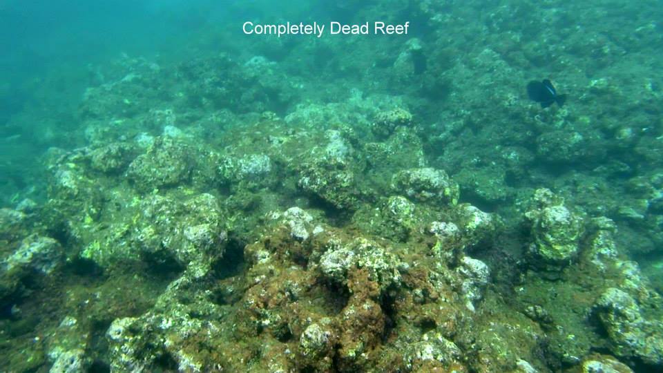
Diseased/dead coral reefs correlate well with locations of high gain, high EIRP microwave radars and earthstations after 6 months of reef surveys by Terry Lilley in Kauai, HI. Ivory tower dumbass government sucking, contracting consultants didn’t even think to check.
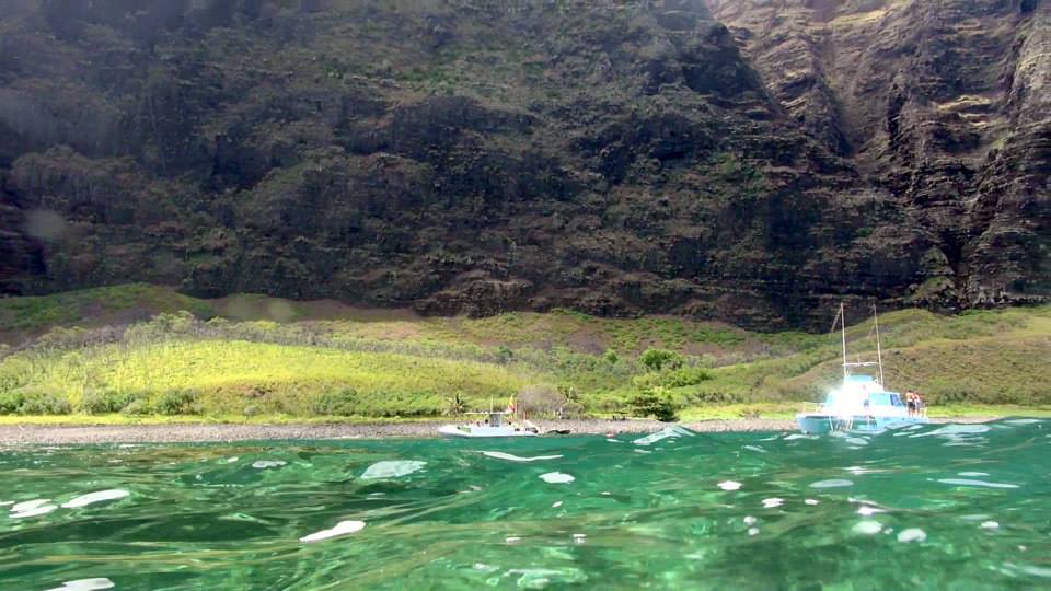
Just the facts. I did a dive yesterday at Nualolo and Miliolii along the Na Pali Coast and the reefs have 99% died in the last three years! All the way to the outer reefs. This famous place in Hawaiian history is now dead. There are no homes there. No run off. Very little rain. Clear deep water flushes the reefs daily. There is no farming or agricultural run off. Nualolo should be a pristine coral reef!! What is there are several giant 6 million watt microwave towers! These towers were “weoponized” two years ago to be used in the Military electronic war games that operate all along the north shore of Kauai daily. One month after the towers were jacked up to millions of watts the reef stated to die. I have before and after video!
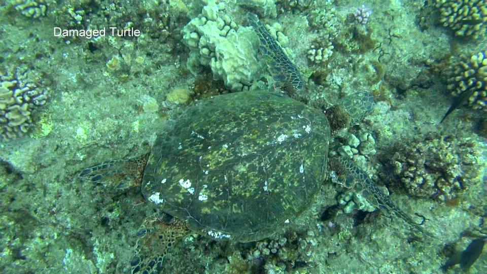
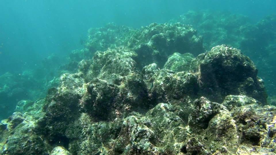
Now there is nothing left but a few algae eating fish like the nenue and manini.
Are we going to continue to allow the US military to kill our entire coastline in the name of “national defense”. Our politicians pump millions of dollars monthly into expanding the base and electronic war. When will it all stop? Kauai has its own DNA bloodlines of coral. Our corals are different from all the other corals in Hawaii so we cannot transplant coral from Maui or the Big Island after the military kills the reef. We must save a little bit of coral to regrow when the madness stops.
Even the tourist will get bored soon with seeing a brown dead reef devoid of coral and butterfly fish!


 What a beautiful gift we have left our children!
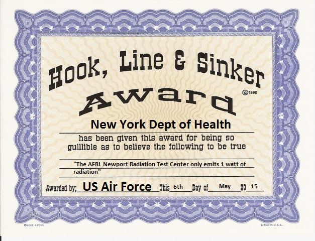
When I said it was safe to transmit that much radiation into the atmosphere.
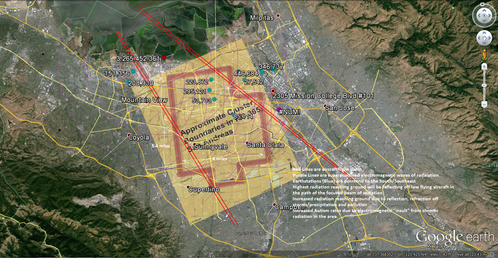
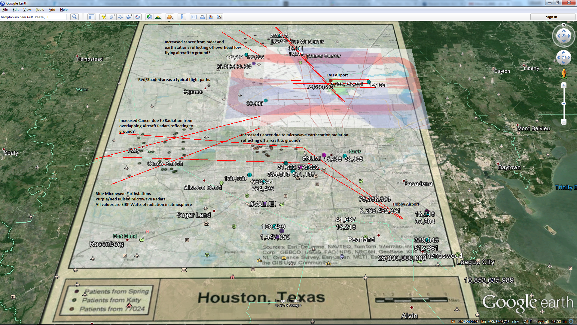
Autism Cluster Map/Research Source: UC Davis. Earthstation/Radar Database compliments my Awesome Research All values are EIRP Watts. Blue are “always on” microwave Earthstations, Red are pulsed microwave radars. Red Lines are airport flight paths (more reflection of microwaves to ground off airplanes)
Until further notice and in line with current national policies, our government will make the following acronym changes while striving to minimize costs
FAA: Federal Autism Administration
FCC: Federal Cancer Commission
NOAA: National Oceanic Annihilation Administration
NASA: National Aquatic Shock Administration
IEEE: Ignorant Electrical Engineers Electromagneticuting you
RIMPAC: Radiation Intense Microwave Pulses Annihilating Coral
DoD: Department of Destruction

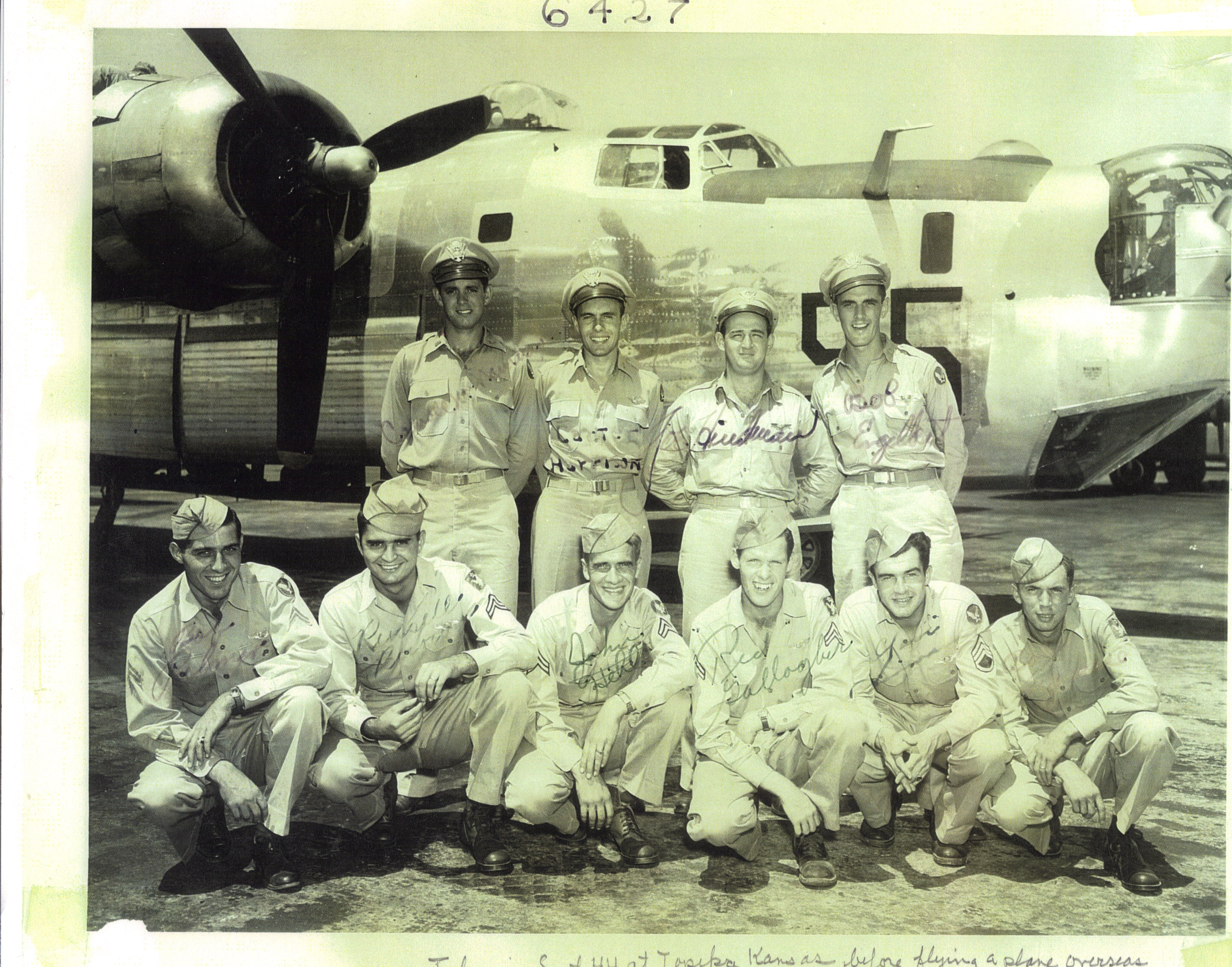
My father, second from bottom right
http://en.wikipedia.org/wiki/Consolidated_B-24_Liberator#Operational_history
“The B-17 and B-24 averaged 30 and 35 accidents per 100,000 flight hours, respectively—-a horrific figure considering that from 1980 to 2000 the Air Force’s major mishap rate was less than 2.”
Source: http://www.usshancockcv19.com/history6.htm
Unbroken – VFX Breakdown from Rodeo FX on Vimeo.
 Tab 1_QA Response_CM Hanna Congressional Inquiry_v2 (1)
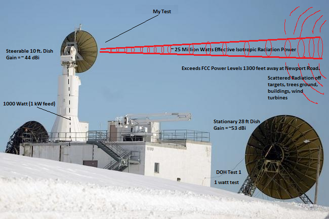
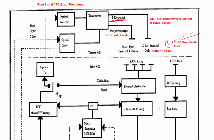
https://darkmattersalot.com/wp-content/uploads/2015/03/ada347013.pdf The military only tested the low power fixed dishes! 10 foot steerable dish has a 1000 watt feed and generates 25 million watts of effective isotropic radiation!

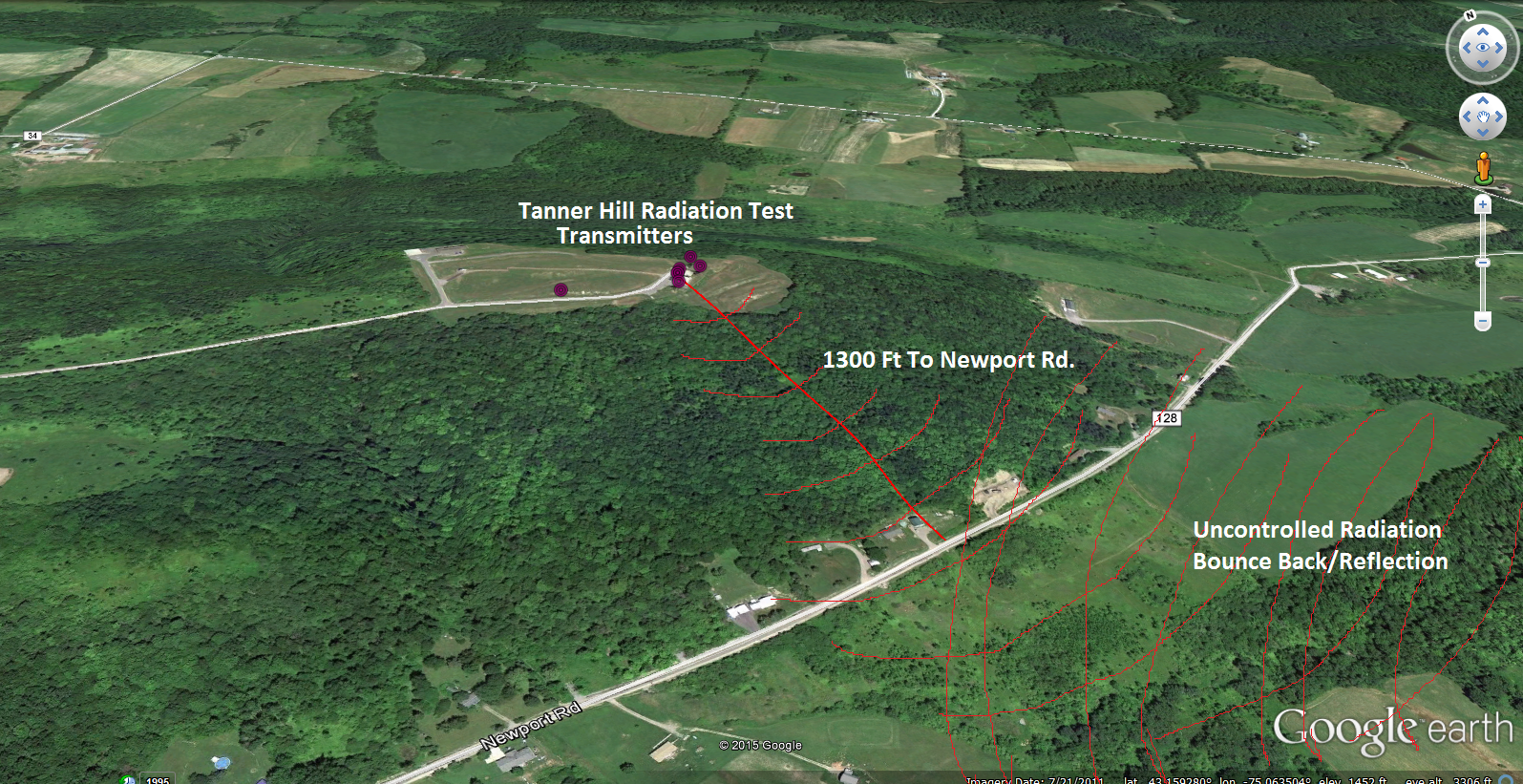
Over 1000 watts fed to the parabolic dishes on Tanner Hill. Newport Rd. is only 1300 feet away. Lots of radiation scatter off trees, cars, RF fencing on other side of the road. EXCEEDS FCC Guideline for uncontrolled area.
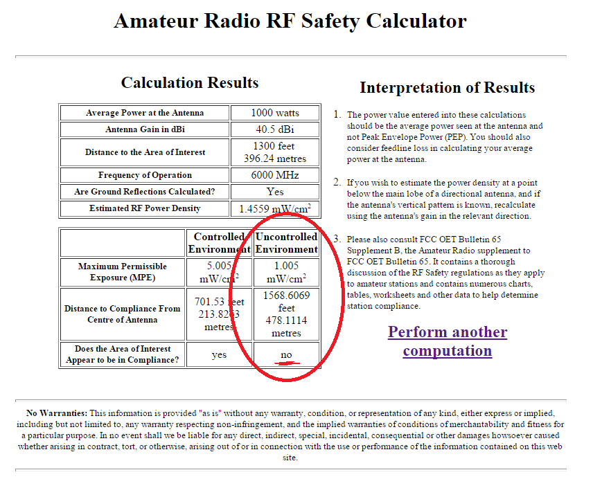
10 foot steerable parabolic dish estimated Gain: 40.5 dBi (conservative).
Check my math, I don’t make this shit up: http://hintlink.com/power_density.htm
Air Force’s Lame Response to my questions. I help pay their salary and there are a lot of sick kids in the area.
What do you think Dr. Hawking?


